Ben Lomond National Park
turapina (palawa kani)
Tasmania's alpine crown - a dolerite plateau where ski runs, wildflower meadows and sweeping northern vistas share the same ancient stone.
On the lands of the Ben Lomond Nation (Plangermaireener, Plindermairhemener and Tonenerweenerlarmenne clans) people.
schedule 3 min read / Updated Jun 2026
Perched above north-east Tasmania at elevations exceeding 1,500 metres, Ben Lomond National Park is the island state's premier alpine destination - a vast Jurassic dolerite plateau ringed by sheer escarpments and cloaked in buttongrass, cushion plants and alpine wildflowers. Legges Tor, the park's high point at 1,572 metres, is Tasmania's second-tallest peak, and the famous Jacob's Ladder - six breathtaking switchbacks cut into the cliff face - has become as much a rite of passage for road trippers as it is for professional cyclists who train on its relentless gradient. Whether you come in winter for the ski slopes or in summer for the walking tracks and wildflower displays, Ben Lomond rewards every visitor with a sense of genuine remoteness just over an hour from Launceston.
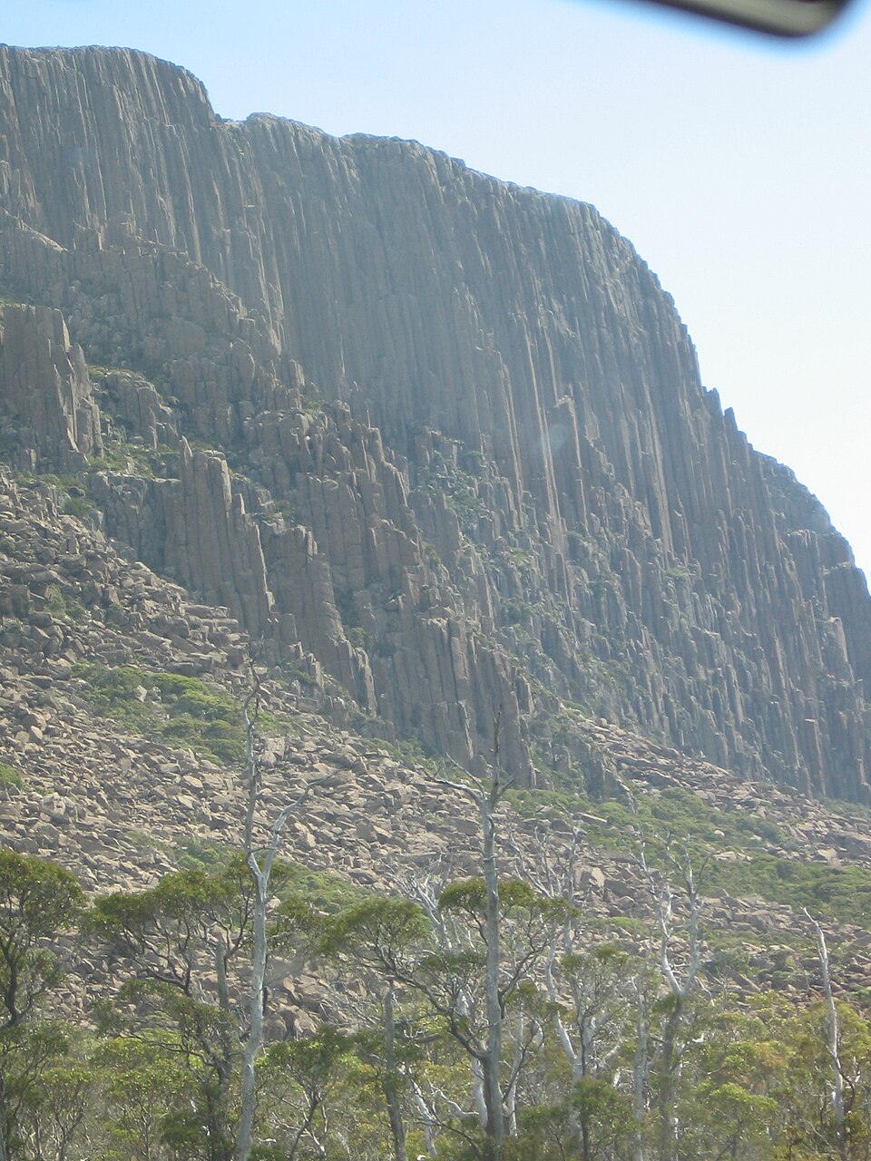
The plateau that crowns Ben Lomond is one of the oldest continuously occupied landscapes in Tasmania. The Ben Lomond Nation - comprising the Plangermaireener, Plindermairhemener and Tonenerweenerlarmenne clans - called this highland home for tens of thousands of years before European contact, and their deep connection to country is reflected in the palawa kani name turapina. The plateau was also known as Torbunna, and Lake Youl carries its Aboriginal name minamata, meaning "lake" or "lagoon". Today the park formally acknowledges this living heritage, and Aboriginal cultural values are embedded in its management plan.\n\nGeologically, Ben Lomond is a remnant of the vast Jurassic dolerite intrusions that define so much of Tasmania's highland scenery. During the Pleistocene Ice Age the plateau was the only glaciated landscape in north-eastern Tasmania, and the rounded tors, tarns and soliflucted soils left behind tell a story of deep cold. More than 220 plant species have been recorded on the plateau, including endemic cushion plants, richea, pencil pines near the treeline, and spectacular summer displays of alpine herbs. The park is equally rewarding for wildlife-watchers: wombats and Bennett's wallabies are frequently spotted near the alpine village, eastern quolls hunt the open moorland after dark, and the endangered endemic Ben Lomond skink (Niveoscincus greeni) basks on dolerite boulders in the warmer months. Wedge-tailed eagles ride thermals above the escarpment year-round.\n\nWinter transforms the park into Tasmania's most popular snow destination. Ben Lomond Alpine Resort operates ten downhill trails with a vertical drop of 112 metres, plus terrain for cross-country skiing, snowshoeing and tobogganing. The original chalet was built in 1932, making this one of Australia's oldest ski facilities; the sealed road was extended to the plateau in 1963, opening the resort to a wider public. Between June and September all vehicles are required to carry correctly fitted snow chains, and a shuttle bus service runs from the base during peak season. Snow conditions vary considerably from year to year, so checking the resort's website before travel is strongly recommended.\n\nOnce the snow melts, the plateau opens up for walkers of all fitness levels. The Summit Link Track is a gentle one-kilometre Grade 2 stroll from the alpine village to panoramic viewpoints, while the Summit Pass Track is a five-kilometre circuit taking roughly three hours and visiting the most dramatic escarpment edges. For a more committed outing, the route from the alpine village to Little Hell covers 5.5 kilometres each way through open moorland and takes around ninety minutes each way. All walks are best done in summer and autumn when tracks are clear of ice, days are long and the alpine wildflowers are at their peak. Sturdy waterproof footwear and an extra layer are essential regardless of season, as conditions on the plateau can change rapidly.\n\nAccess to the park is via the C432 Ben Lomond Road from the township of Blessington, roughly 54 kilometres south-east of Launceston. The final approach is the legendary Jacob's Ladder, a series of six tight switchbacks carved into the dolerite escarpment with spectacular views back across northern Tasmania. A valid Tasmania Parks Pass is required for entry - a daily vehicle pass currently costs $47.70 (up to eight occupants) and can be purchased online or at self-registration boxes near the park entrance. The nearest full-service town is Blessington, while Launceston provides all major services and connects to the rest of Australia via Launceston Airport (LST), approximately 58 kilometres from the park.
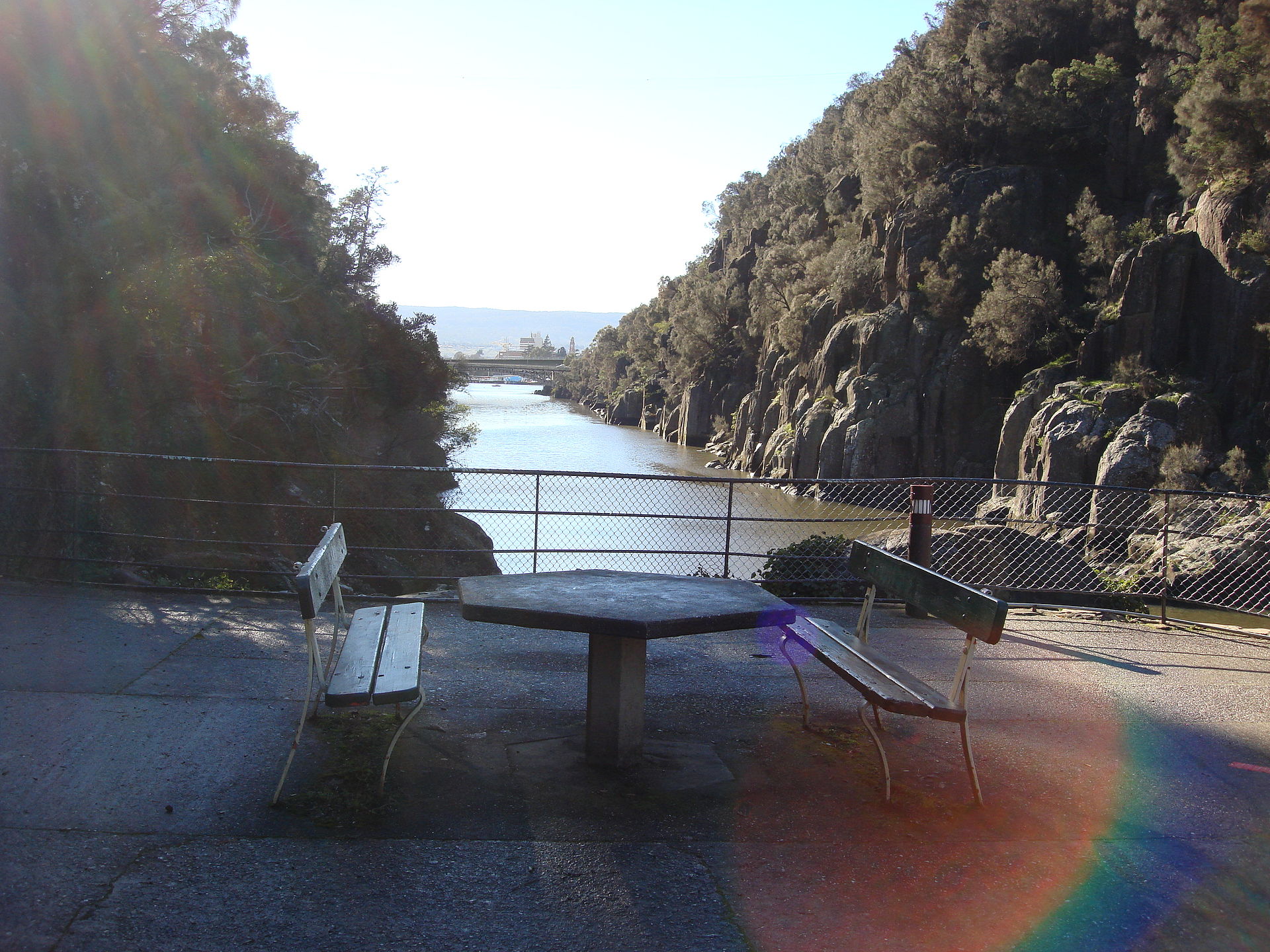
Scenic views
Lookouts near Ben Lomond National Park.
You may also like


Attribution
Sources & credits
Content (1)
Images (1)
Images sourced from Wikimedia Commons under licenses that permit commercial use. If you are the rights holder and believe an attribution is incorrect, please contact us.