Whitsunday Islands
74 Islands, One Reef
Whitsunday Islands
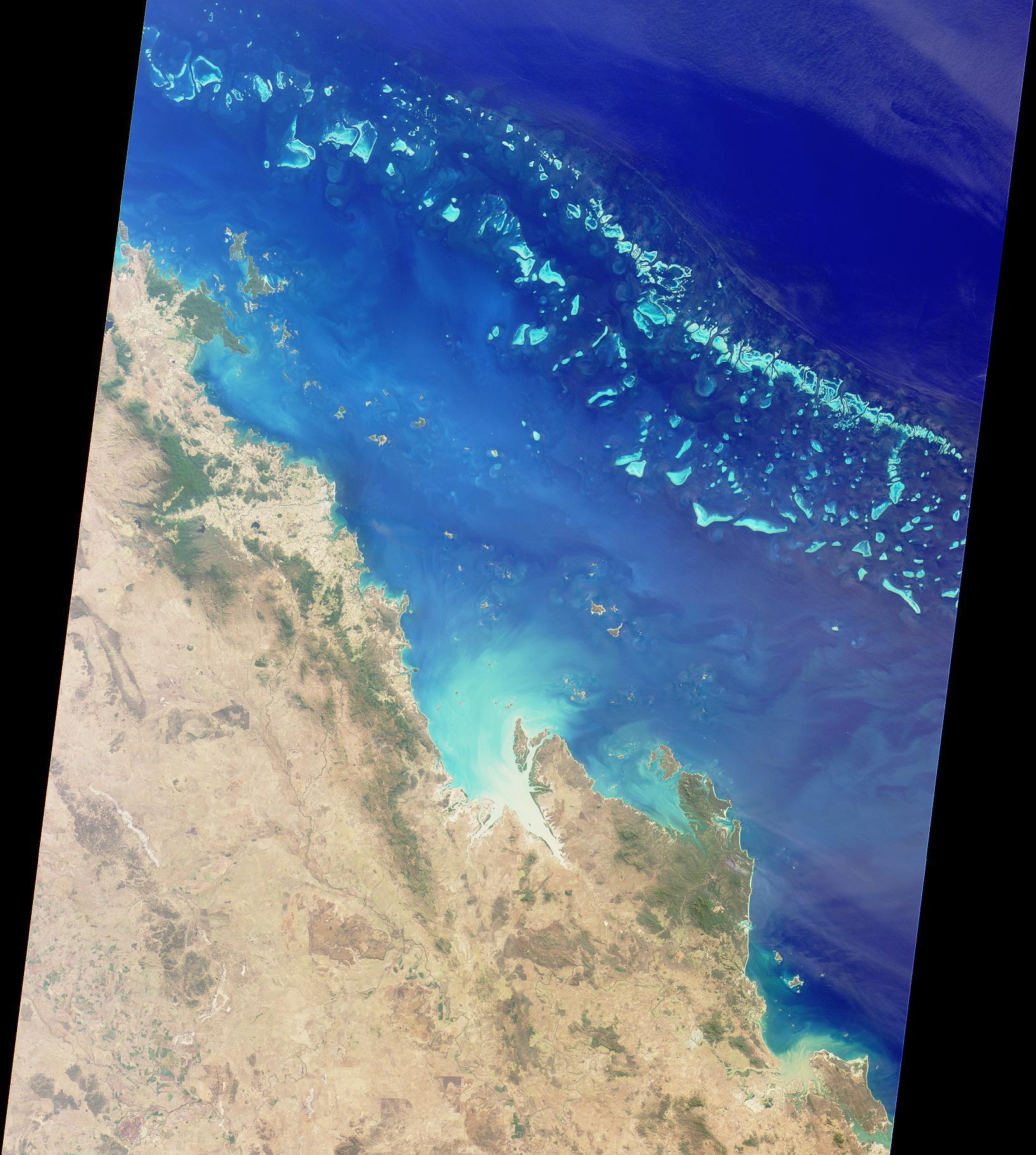
The Whitsunday Islands are a group of 74 islands in the Coral Sea off the coast of central Queensland, lying roughly halfway between Brisbane and Cairns. Most of the islands are part of the Whitsunday Islands National Park and are uninhabited. The Whitsunday group was named by Captain James Cook on Whit Sunday (Pentecost) in June 1770, though he was actually a day out due to the international date line, meaning he was technically there on Whit Monday.
The traditional owners are the Ngaro people, one of the earliest seafaring Aboriginal cultures in Australia, whose connection to the islands goes back more than 9,000 years. The Ngaro people used bark canoes to navigate between the islands and the mainland and had established trade networks along the coast. Several sites across the islands still contain Ngaro rock paintings, middens and ceremonial grounds, and cultural tours led by Ngaro guides are among the most respected indigenous tourism experiences in Queensland.
The geological story explains why the islands are the way they are. Around 8,000 years ago, at the end of the last ice age, rising sea levels flooded what had been a coastal range of hills, leaving only the summits above the waterline. These peaks became the Whitsunday islands. Because the islands are former hilltops rather than coral cays, they are green, hilly and forested, unlike the flat coral cays found further out on the reef.
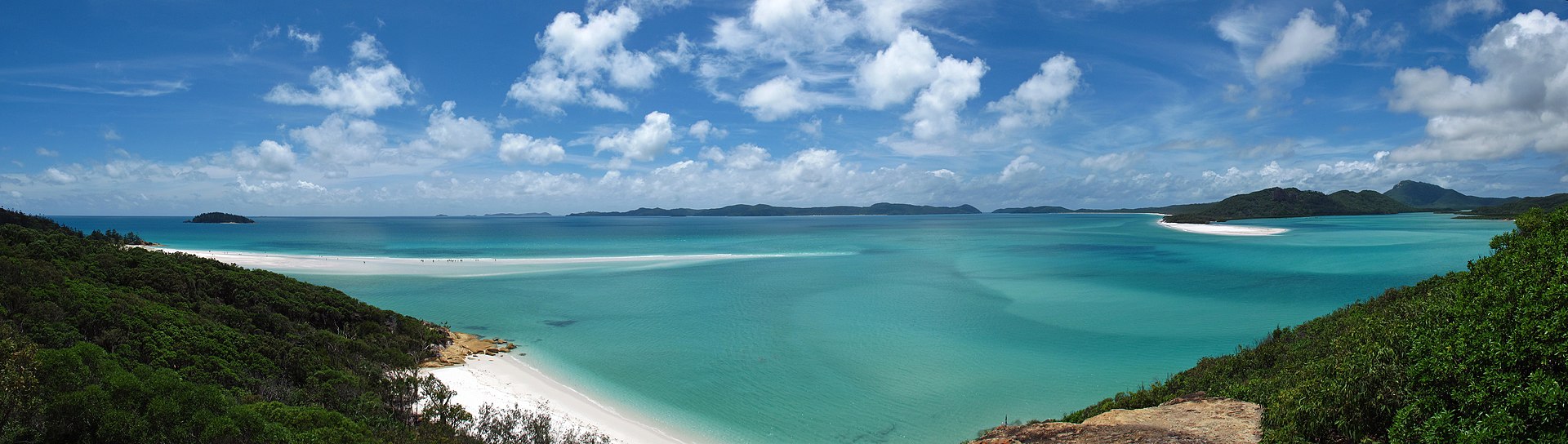
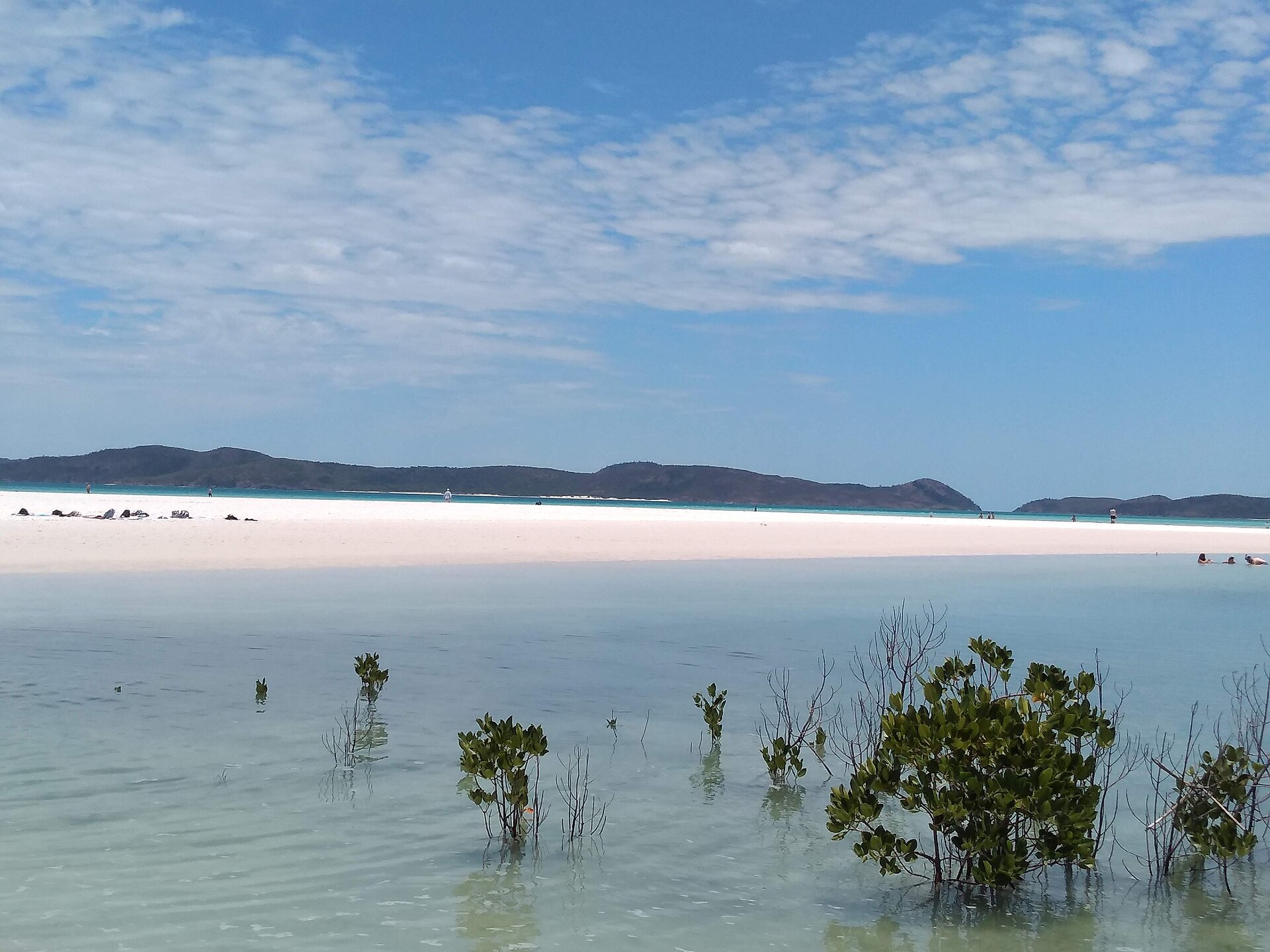
Whitehaven Beach on Whitsunday Island is the most famous single site in the group and one of the top-rated beaches in the world. It runs for 7 kilometres along the eastern side of the island and is made up of 98 percent pure silica sand, giving it a brilliant white colour that reflects heat and stays cool underfoot even in full sun. At the northern end, Hill Inlet is a tidal estuary where the receding tide carries the white sand out into the turquoise water, creating a swirling pattern that changes with every tide and gives the Whitsundays their most iconic photograph.
The islands sit inside the Great Barrier Reef Marine Park, and unlike the outer reef, the waters between the islands are sheltered, relatively shallow and sometimes warmer, which has protected them from the worst impacts of recent mass bleaching events. The fringing reefs around Hook Island, Border Island, Bait Reef and others offer outstanding snorkelling and diving, and are often in better condition than the better-known outer-reef sites further north.
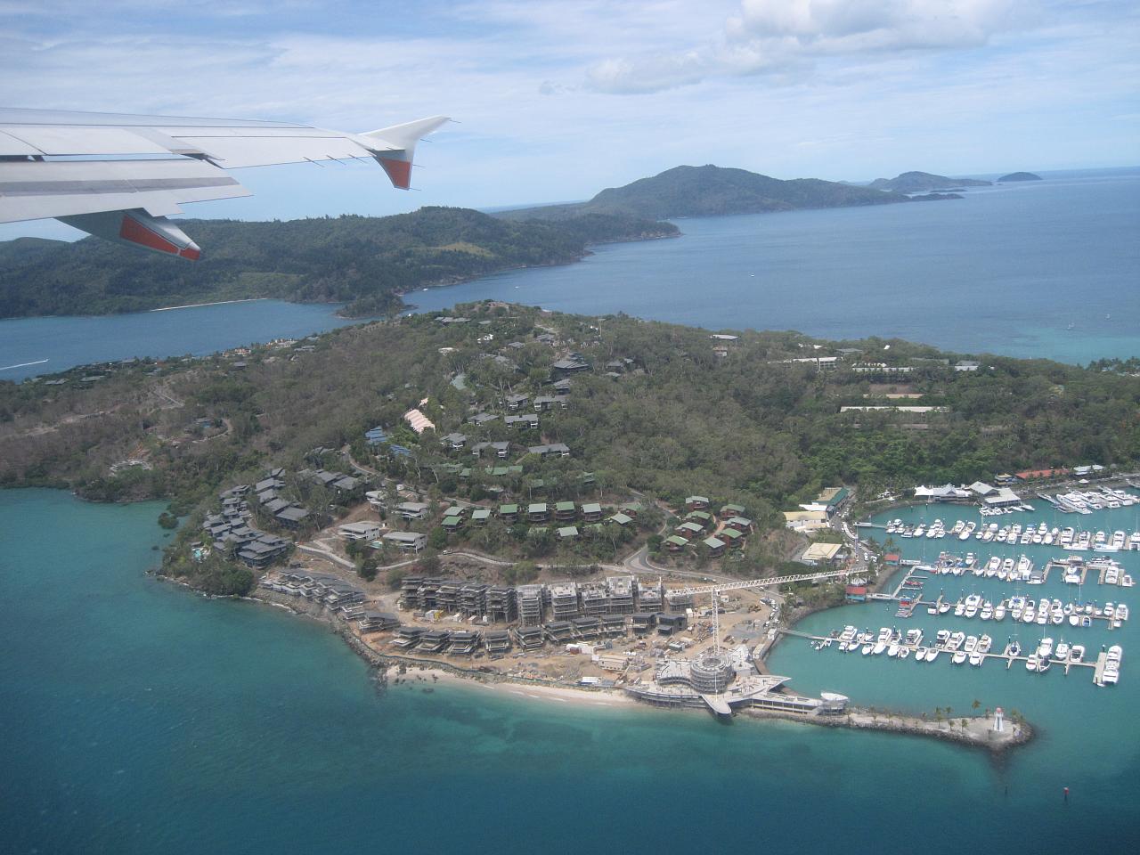
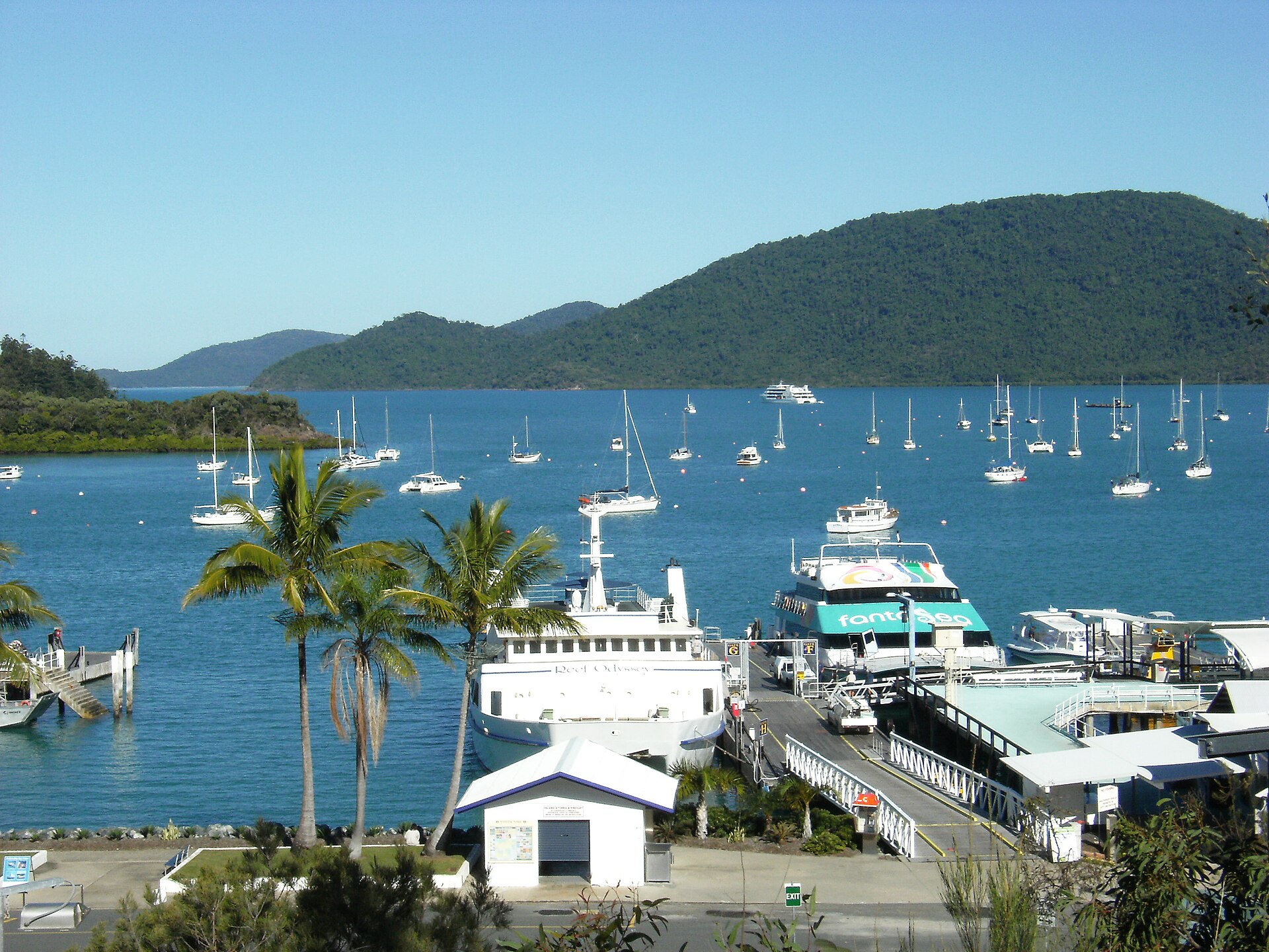
Airlie Beach on the mainland is the primary gateway for backpackers and independent travellers, with dozens of operators running day trips, overnight sailing cruises and diving expeditions. Hamilton Island, the only island in the group with a commercial airport, is the luxury end of the market. Daydream Island and Long Island cater to the resort crowd. For those wanting to stay on an uninhabited island, the national park operates bush campsites on several islands that can be booked online.
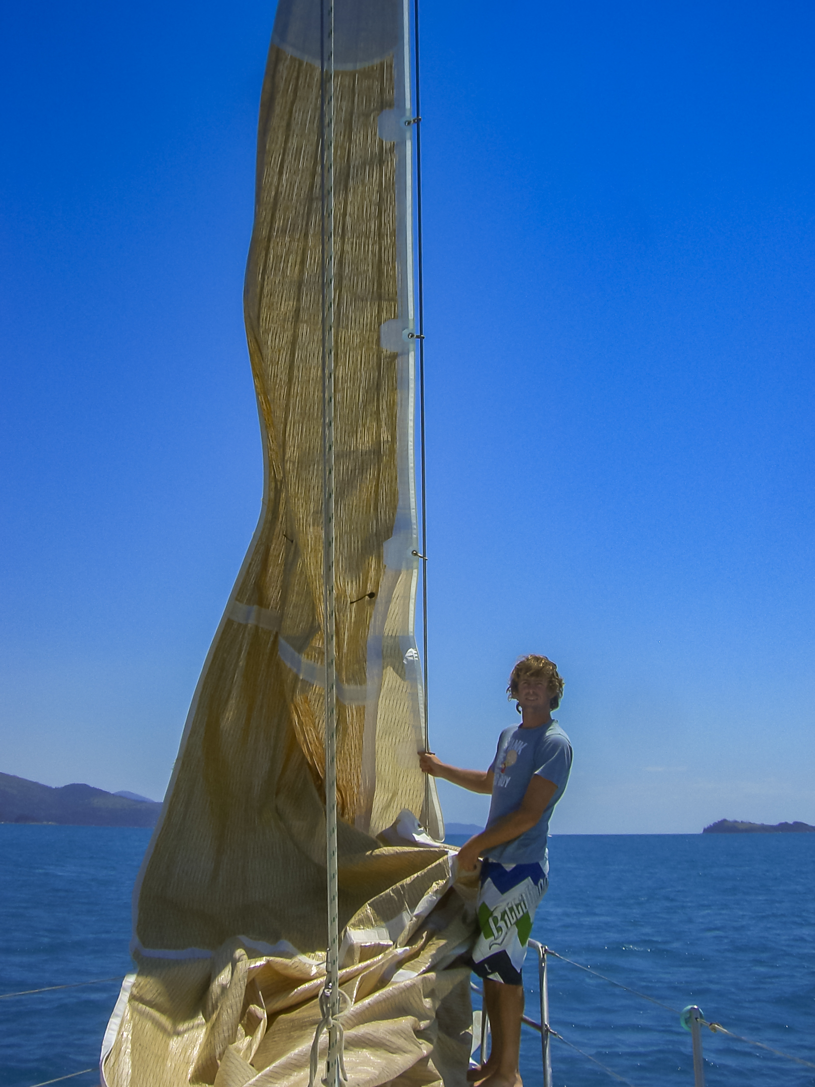
Sailing is the classic way to experience the Whitsundays. The trade winds from May to October provide consistent and reliable sailing conditions, and the islands are close enough together that you can easily cover four or five in a three-day trip. Both crewed cruises and bareboat charters (where you rent the yacht yourself) are available from Airlie Beach, with options ranging from single day trips to multi-day live-aboard sailing experiences.
The best months for visiting are May to October, when rainfall is lowest, humidity is manageable, winds are steady and box jellyfish are absent. November to April is the wet season, which brings warmer water but also stinger suits, afternoon storms and the occasional cyclone threat. Cyclones are rare but not unheard of, and the 2017 Cyclone Debbie caused significant damage to Hamilton Island and Hayman Island that took years to repair.
Where to stay
Holiday parks near Whitsunday Islands.
3 options via our booking partner
BIG4 Whitsunday Islands Holiday Park
Flametree
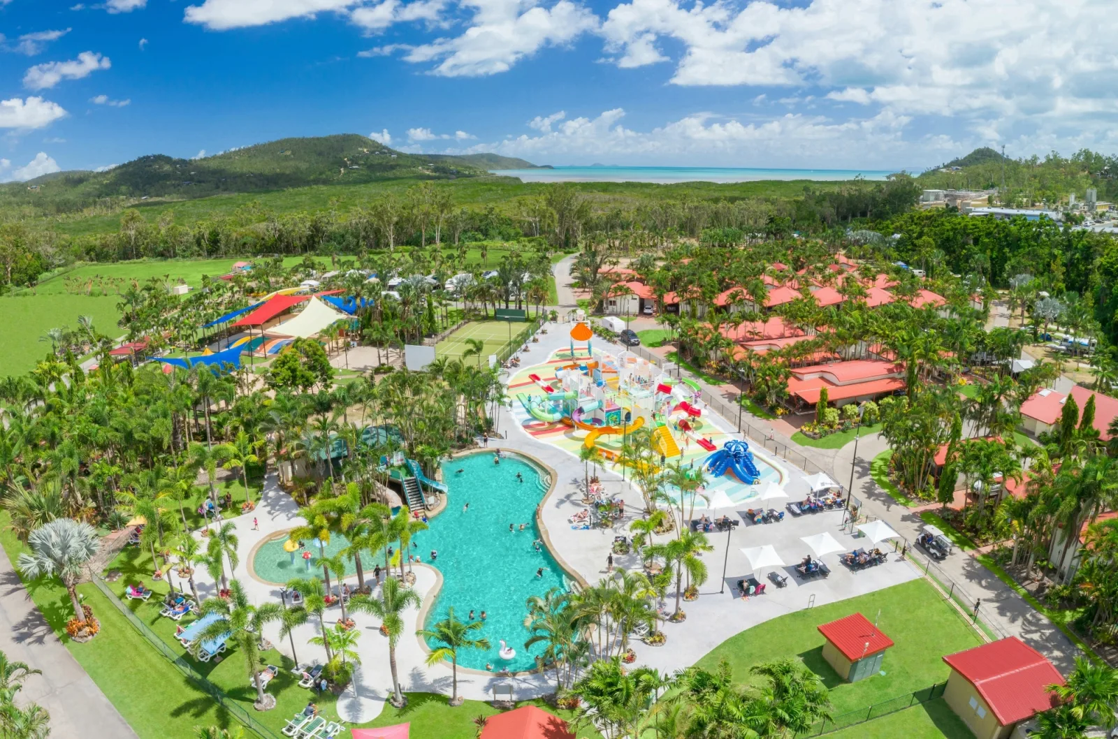
BIG4 Adventure Whitsunday Resort
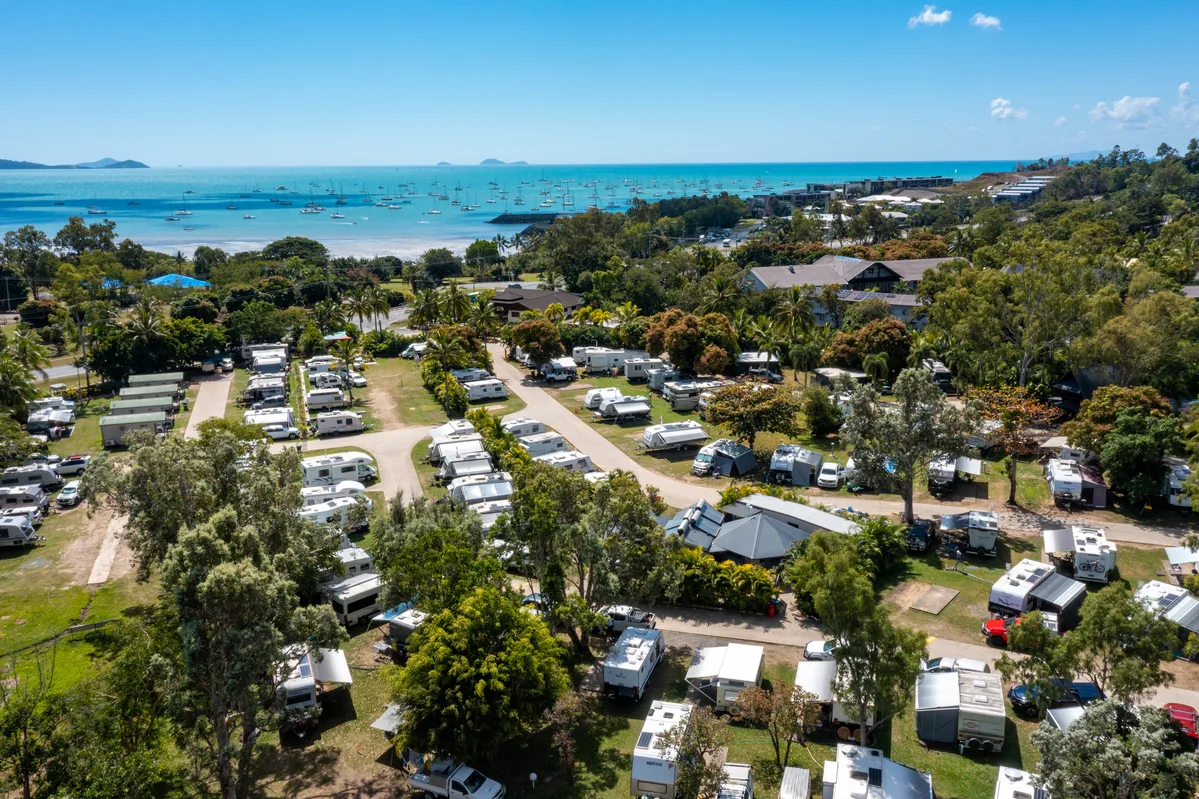
NRMA Airlie Beach Holiday Park
Bookings handled by our partner Parkbooker. We may earn a commission at no extra cost to you.
Gallery
Whitsunday Islands in pictures.
9 images licensed from Wikimedia Commons

![500px provided description: Die Whitsunday Islands sind eine Inselgruppe vor der Ostk?ste des australischen Bundesstaates Queensland. [#landscape ,#nature ,#beach ,#travel ,#sun ,#freedom ,#vacation ,#live ,#relax ,#under ,#trip ,#australia ,#holiday ,#down ,#queensland ,#natur ,#sonne ,#au ,#strand ,#australien ,#urlaub ,#landschaft ,#freiheit ,#reise ,#geotagged ,#downunder ,#allgemein ,#whitsundayisland]](https://wheredownunder.au/storage/places/whitsunday-islands/whitsunday-islands-filesandbank-whitsunday-islands-134205417-nabzd7.jpg)
All images are sourced from Wikimedia Commons under Creative Commons licences. Individual photographers are credited on the source pages.
On the itinerary
Trip plans that include Whitsunday Islands.
You may also like


Attribution
Sources & credits
Content
- Background text summarised from Wikipedia: Whitsunday Islands , licensed under CC BY-SA 4.0.
Images (9)
- GreatBarrierReef-PIA03401.jpg · Public domain
- 06. Whiteheaven Beach.jpg · Elemaki · CC BY-SA 3.0
- Hamilton Island, Queensland.jpg · idrewuk · CC BY 2.0
- Hamilton Island, Whitsundays 1, Australia.jpg · ThingOnASpring · CC BY 2.0
- Sandbank Whitsunday Islands (134205417).jpeg · Dronepicr · CC BY 3.0
- Seeadler Whitsunday Islands National Park (24061837296).jpg · dronepicr · CC BY 2.0
- Segeltour Whitsunday Islands National Park (23792250850).jpg · dronepicr · CC BY 2.0
- Shute Harbour in the Whitsunday Islands, Queensland, Austral... · Theo Crazzolara · CC BY 2.0
- Whitehaven Beach, Whitsunday Islands National Park.jpg · Timothy Wakeham · CC BY-SA 4.0
.jpeg)
.jpg)
.jpg)
Images sourced from Wikimedia Commons under licenses that permit commercial use. If you are the rights holder and believe an attribution is incorrect, please contact us.