Larapinta Trail
Tjoritja
Walk the ancient spine of Central Australia through 12 sections of raw red-rock wilderness.
On the lands of the Arrernte people people.
schedule 3 min read / Updated Jun 2026
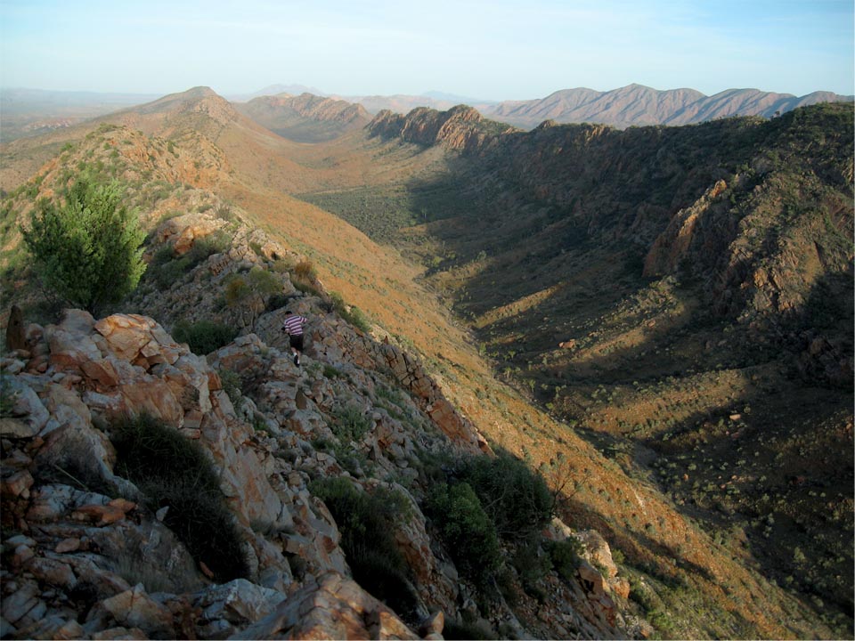
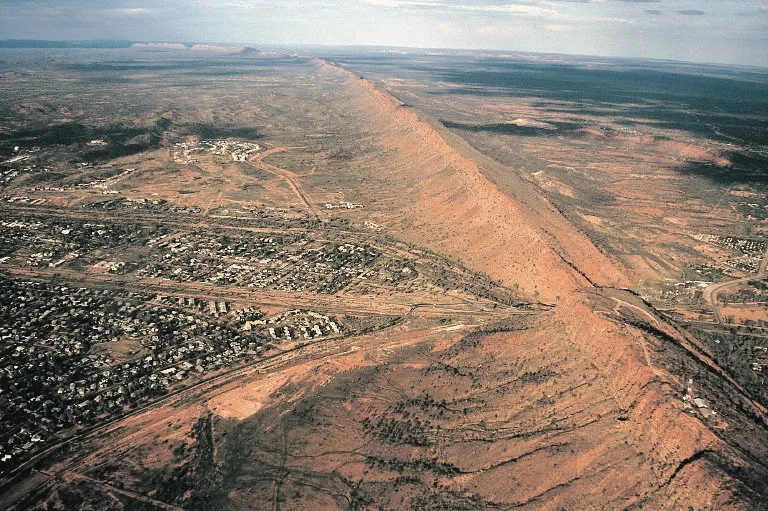
The Larapinta Trail stretches 223 kilometres along the spine of the West MacDonnell Ranges (Tjoritja) from Alice Springs westward to Mount Sonder - one of the Northern Territory's highest peaks - threading through gorges, ancient riverbeds and sacred Arrernte country. Divided into 12 sections, it is widely regarded as one of Australia's great long-distance walks, drawing experienced hikers from around the world to its rugged quartzite ridgelines and luminous night skies. The trail is jointly managed by the Northern Territory Government and Arrernte Traditional Owners, whose Dreaming stories are woven into every landmark along the route.
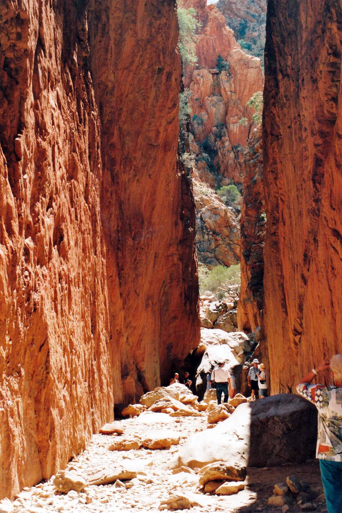
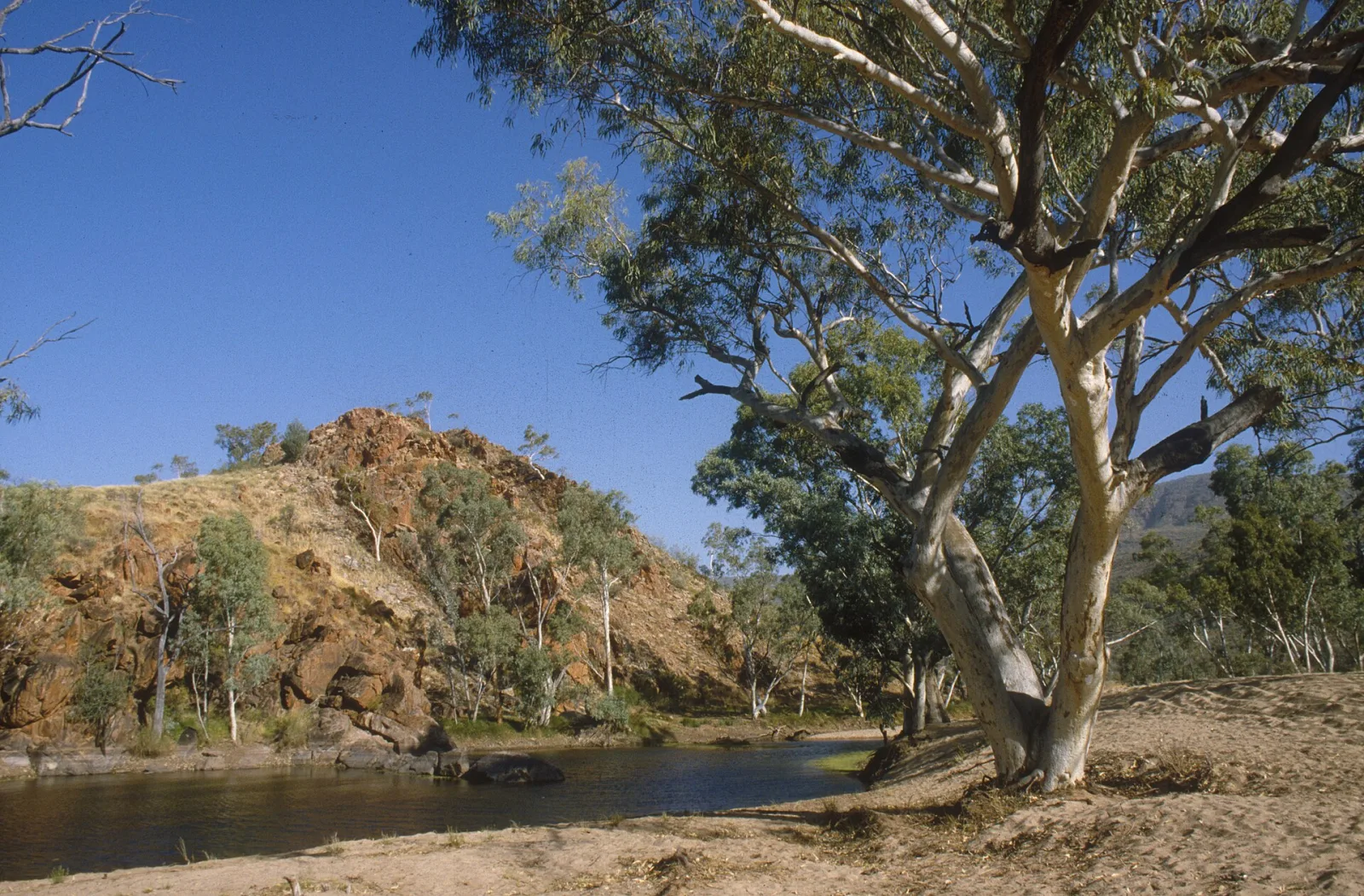
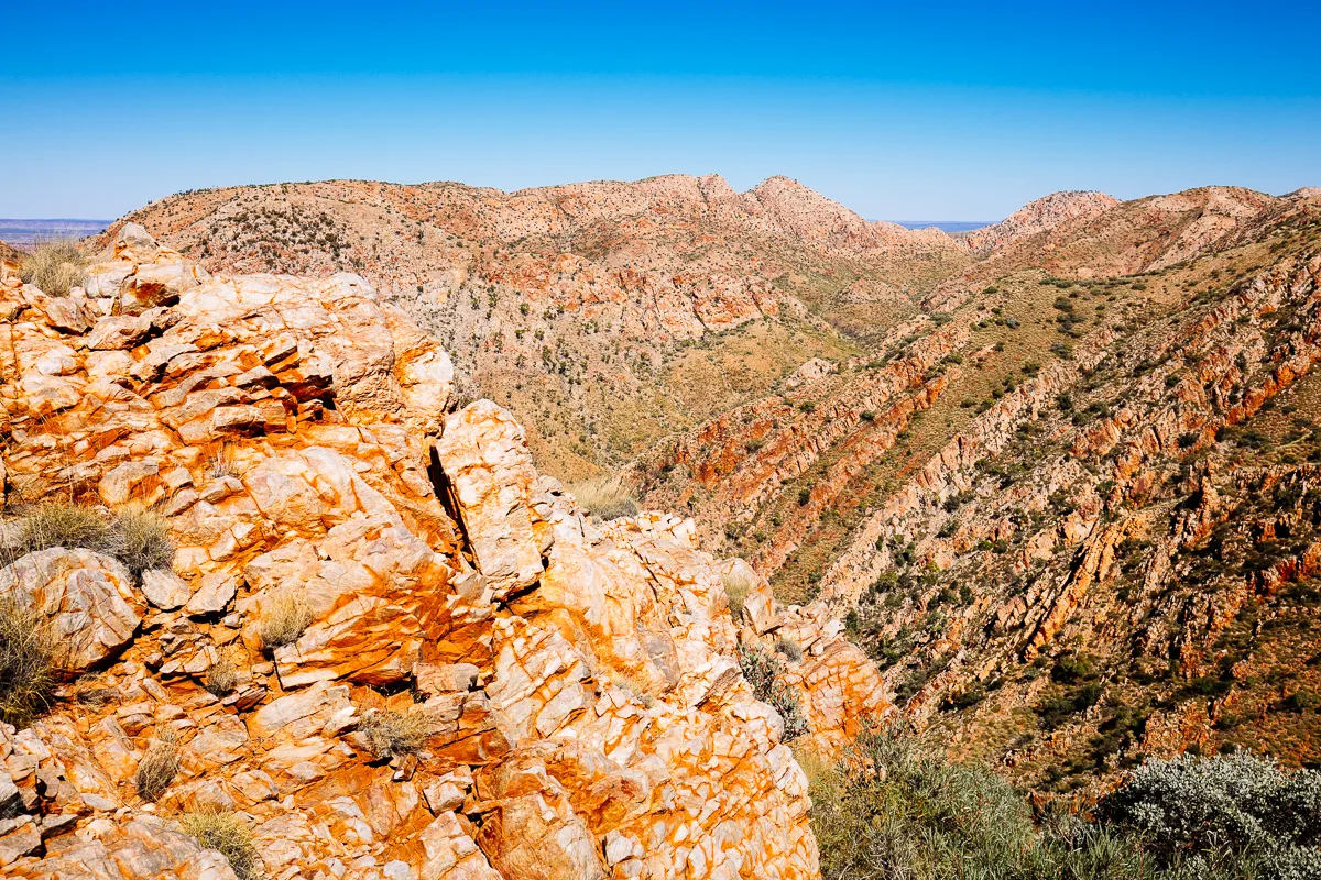
The Larapinta Trail follows some of the oldest geological country on Earth. The West MacDonnell Ranges began forming around 350 million years ago, and the Finke River - whose Arrernte name, Larapinta, gives the trail its title - is widely considered one of the oldest riverbeds on the planet. Walking the trail is as much a journey through deep time as it is a physical challenge, with ochre-streaked cliff faces, ancient cycad groves and dry creek beds that flash with colour after rare rainfall. The Arrernte people have authorised visitor access to these lands, and hikers are asked to approach sacred sites with respect.\n\nThe 12 numbered sections vary considerably in character and difficulty. The eastern sections near Alice Springs - passing Simpsons Gap (Rungutjirpa) and Standley Chasm (Angkerle Atwatye) - offer more accessible terrain with day-trip options available. The western sections become progressively more remote and demanding, culminating in the Section 12 ascent of Mount Sonder (Rrewtyepme) at around 1380 metres. Iconic highlights include the Ochre Pits, Ormiston Gorge and Pound, and the deep slot canyon at Redbank Gorge. Each section features kilometre markers, notice boards and water sources - either natural or via storage tanks installed by Parks and Wildlife.\n\nBecause the trail crosses genuine semi-arid desert, walking conditions vary sharply with the seasons. Summer temperatures regularly exceed 45 degrees Celsius and render most of the route genuinely dangerous; the trail is formally discouraged in December through February. The sweet spot for a full end-to-end traverse is May to August, when daytime temperatures settle between 20 and 27 degrees and cold, clear nights produce some of the most vivid stargazing in Australia. Autumn and spring shoulder seasons are also popular, though September and October bring rising heat. Flash flooding can close creek crossing sections during and after rain at any time of year.\n\nA full end-to-end walk takes most people between 12 and 17 days, with the NT Parks service recommending up to 20 days if side trips are included. Logistics require advance planning: food drops are arranged at key road crossings, water must be tracked carefully between sources, and online booking with NT Parks is required before you depart. Multi-day walking fees apply ($25 per person for a one-night trip up to a capped $125 for five or more nights), with campsite fees of $10 per night at Parks and Wildlife-managed sites in addition. Independent walkers can tackle any single section as a day walk or overnight trip without committing to the full route, making the trail accessible to a wide range of fitness levels.\n\nThe trail passes through country of immense cultural significance. The Arrernte creation narrative describes three caterpillar ancestral beings - Ayepe-arenye, Ntyarlke and Utnerrengatye - whose journeys shaped the MacDonnell Ranges and embedded a network of sacred sites across the landscape. Many gorges and waterholes remain active ceremonial places. Tjoritja/West MacDonnell National Park, which encompasses the trail, is co-managed under a joint arrangement between the NT Government and Arrernte Traditional Owners, and a portion of park fees flows back to land management on Country. For visitors, this cultural context transforms what might otherwise be a purely physical challenge into an encounter with one of the world's oldest living cultures.
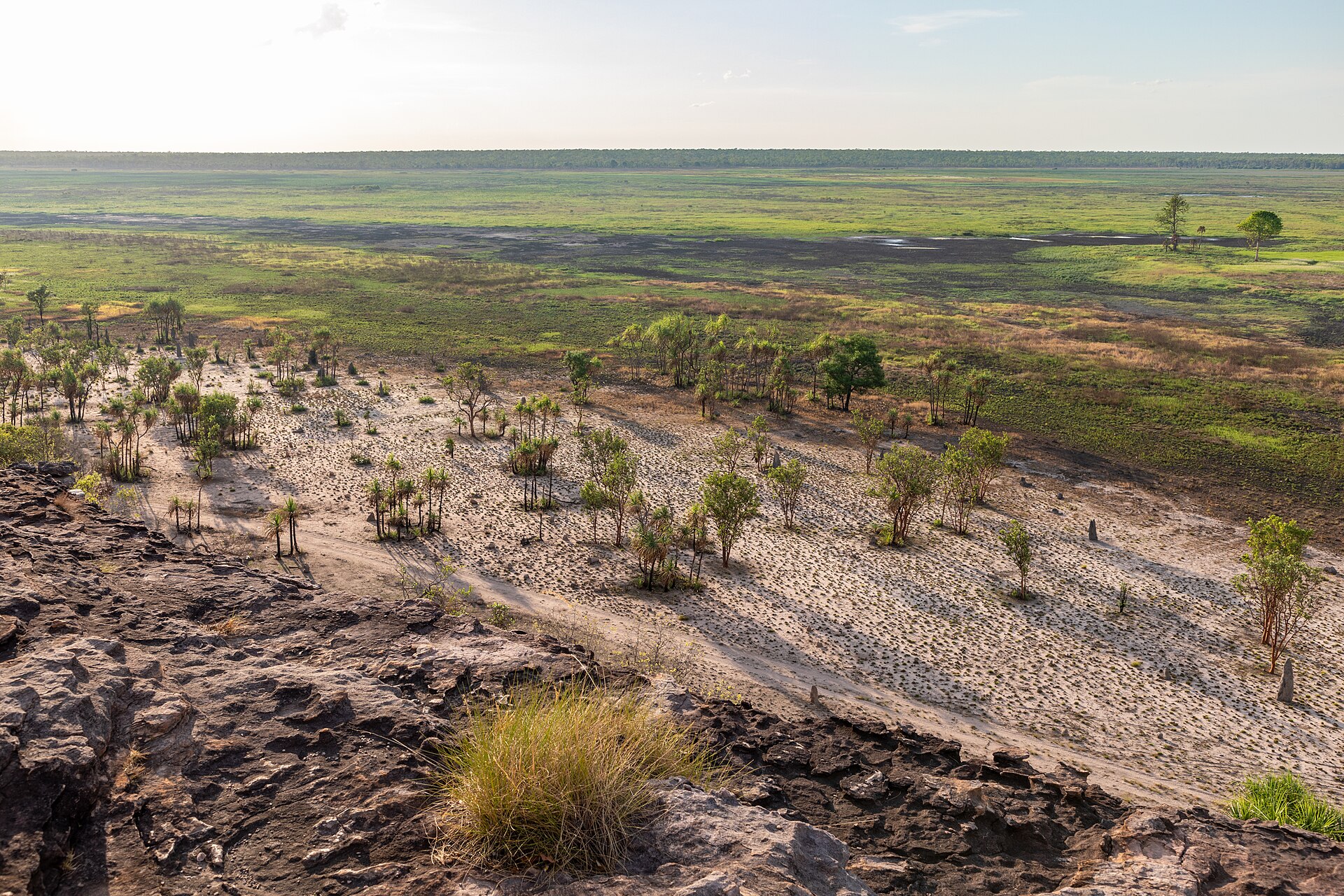
Scenic views
Lookouts near Larapinta Trail.
You may also like
Standley Chasm
MacDonnell Ranges
Alice Springs
East MacDonnell Ranges

Chambers Pillar
Kakadu National Park

Daly Waters

Mount Conner (Atila)
Ubirr

Devils Marbles (Karlu Karlu)
Yulara
West MacDonnell Ranges
Attribution
Sources & credits
Content (1)
Images (1)
- Alice Springs Larapinta Trail.jpg · Nigel Malone · CC BY-SA 1.0
Images sourced from Wikimedia Commons under licenses that permit commercial use. If you are the rights holder and believe an attribution is incorrect, please contact us.