
Mount Conner (Atila)
Atila
The outback's mistaken monolith
On the lands of the Pitjantjatjara and Yankunytjatjara people.
schedule 2 min read / Updated Jun 2026
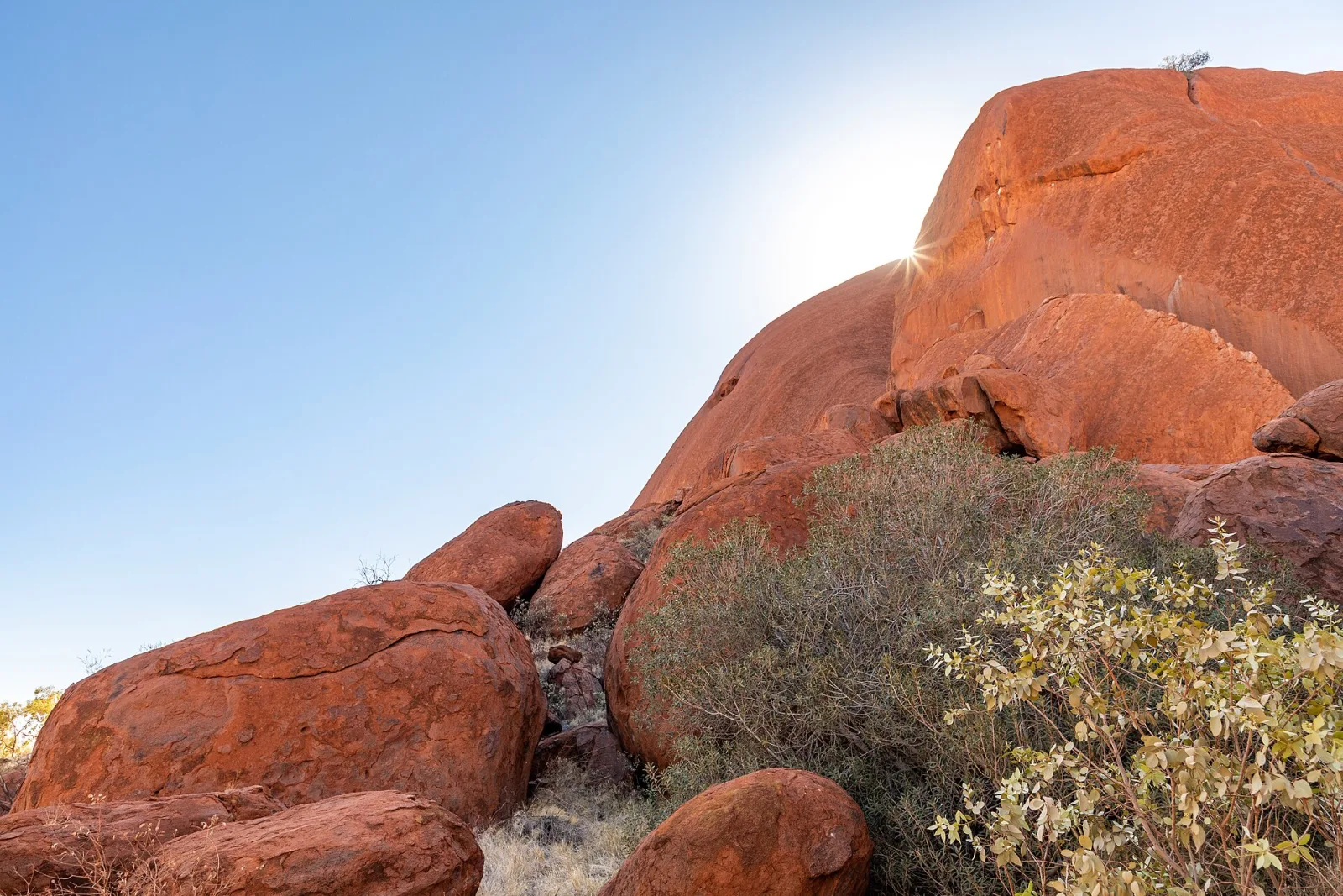
Mount Conner, known to the Pitjantjatjara and Yankunytjatjara people as Atila, is a commanding flat-topped mesa rising 300 metres above the surrounding desert plains about 100 kilometres east of Uluru. Sitting on the privately owned Curtin Springs Station and flanked by a shimmering salt lake, it is visible from a free roadside lookout on the Lasseter Highway. Many travellers driving toward Uluru mistake it for their destination, giving rise to the affectionate nickname Fooluru.
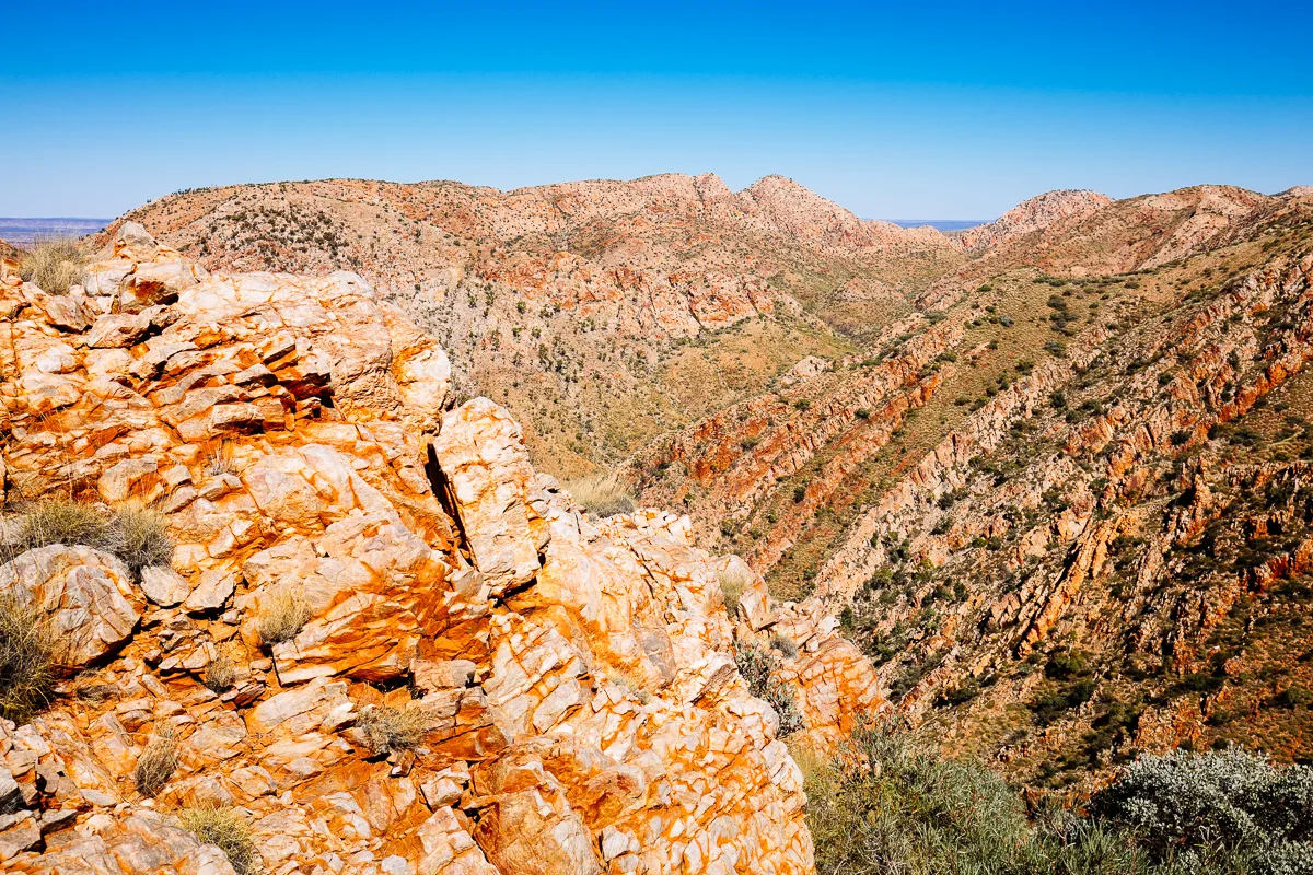
Mount Conner stands at 859 metres above sea level in the Petermann locality of the Northern Territory, in Pitjantjatjara country. Its horseshoe-shaped silhouette and stark flat summit are the product of hundreds of millions of years of geological history. The mesa is a classic inselberg, an isolated remnant left standing after the surrounding softer rock eroded away. Geologists note that its summit, along with the summits of Uluru and the domes of Kata Tjuta, represents an erosional remnant of a much older land surface, suggesting all three formations share a common ancient origin buried deep beneath the desert.
The mountain holds profound significance for the Anangu people, particularly those speaking Pitjantjatjara. Known as Atila, the formation is associated in Tjukurpa (Dreaming law) with the Ninya, ancestral ice people who brought cold and frost to the land. The songlines connecting Atila to Uluru and Kata Tjuta are part of an intricate web of knowledge about the landscape, water sources, and seasonal patterns. The Kungkarangkalpa (Seven Sisters) Dreaming, one of the most widely sung song cycles across central and western Australia, passes through this country. Sacred details are held privately by knowledge holders and are not shared publicly.
Mount Conner was named by European explorer William Gosse in 1873 after Mountifort Longfield Conner, a South Australian parliamentarian. A sobering footnote in its European history is the death of a schoolteacher in 1936, who perished from exhaustion after mistaking the mesa for Uluru and walking toward it. Today the confusion is gently celebrated in the Fooluru moniker, a reminder of how dramatically the desert landscape can deceive.
The site lies entirely on Curtin Springs Station, a million-acre working cattle property owned by the Severin family since 1956. Public access to the base of the mountain is not available; however, a free roadside lookout on the Lasseter Highway provides excellent views across the salt lake to the mesa. SEIT Outback Australia holds rights to run guided 4WD tours from Curtin Springs onto the station, offering sunset and dinner experiences that bring visitors much closer to Atila than the highway vantage point allows.
The salt lake opposite the lookout is part of the Lake Amadeus palaeodrainage system, a network of saline lakes across this part of the desert. Depending on seasonal rainfall, the lake can hold a thin sheet of water that catches the light dramatically at sunrise or sunset, adding to the visual spectacle of the mesa rising from the flat desert floor. Wildlife in the broader station country includes red kangaroos, wedge-tailed eagles, emus, central bearded dragons, and thorny devils.
Common questions
Things visitors ask about Mount Conner (Atila).
Quick answers to help you plan.
Can I visit Mount Conner without a tour?
expand_more
You can view Mount Conner for free from the sealed lookout on the Lasseter Highway, which provides sweeping views of the mesa and the salt lake in front of it. Access to the base of the mountain requires booking a guided tour with SEIT Outback Australia, the operator with rights to enter Curtin Springs Station for tourism purposes.
Why is Mount Conner called Fooluru?
expand_more
Many travellers driving west along the Lasseter Highway toward Uluru see Mount Conner first and mistake its flat-topped bulk for their destination. The confusion is understandable, as both formations rise dramatically from flat desert plains. The nickname Fooluru is used lightheartedly, but the mountain's traditional Pitjantjatjara name, Atila, carries much deeper significance and is the name its custodians use.
What is the cultural significance of Atila to the Anangu people?
expand_more
Atila is a sacred site in Pitjantjatjara Tjukurpa (Dreaming law), associated with the Ninya, ancestral ice beings said to bring cold to the land. It also sits within the songlines of the Kungkarangkalpa (Seven Sisters) Dreaming, one of the most important and widely shared song cycles across central and western Australia. Specific sacred details are held privately by knowledge holders.
How far is Mount Conner from Uluru?
expand_more
The Mount Conner lookout is approximately 100 kilometres east of Ayers Rock Resort (Yulara) along the Lasseter Highway. Most visitors encounter it on the drive between Alice Springs and Uluru, where it appears on the northern side of the highway well before the Curtin Springs roadhouse.
What is the best time of year to visit Mount Conner?
expand_more
The cooler dry season from May to September is ideal, with daytime temperatures typically between 20 and 25 degrees Celsius and reliably clear skies. Summer months bring extreme heat, regularly above 40 degrees Celsius, and are not recommended for extended roadside stops or outdoor activities in this area.
Is there an entry fee to see Mount Conner?
expand_more
The roadside lookout on the Lasseter Highway is completely free and open at all times. No national park pass is required because the land is privately owned. A guided 4WD tour with SEIT Outback Australia is priced separately and includes a station drive, salt lake visit, sunset viewing, and dinner.
What facilities are at the Mount Conner Lookout?
expand_more
The lookout rest area beside the Lasseter Highway has sealed parking suitable for caravans and campervans, basic toilets, shaded picnic tables, and shelter. There is no mains power or potable water supply on tap. The area is well-signed from both directions and is a standard rest stop on the Uluru road trip corridor.
Scenic views
Lookouts near Mount Conner (Atila).
You may also like
Uluru & Kata Tjuta
Mary River National Park
Litchfield National Park

Mataranka
Alice Springs

Chambers Pillar

Daly Waters

Kings Canyon
Larapinta Trail
West MacDonnell Ranges

Devils Marbles (Karlu Karlu)

Arnhem Land
Attribution
Sources & credits
Content (3)
- Wikipedia: Mount Conner (Atila) · CC BY-SA 4.0
- Mount Conner - Wikipedia · Wikipedia contributors · CC BY-SA 4.0
- Unveiling the Secrets of Mount Conner · SEIT Outback Australia
Images (3)
- Mount Conner in the arid heart of Australia’s Northern Terri... · NASA Johnson Space Center · Public domain
- Mount Connor (14990293730).jpg · Ed Dunens · CC BY 2.0
- Red Centre banner.jpg · Ed Dunens · CC BY 2.0
.jpg)
.jpg)
Images sourced from Wikimedia Commons under licenses that permit commercial use. If you are the rights holder and believe an attribution is incorrect, please contact us.